The Earth’s seasons are caused by three factors:
- The Earth orbits the Sun once a year in a nearly circular orbit.
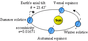
- The Earth’s axis of rotation (the straight line through the center of the Earth between the north and south poles) is not perpendicular to the plane of the Earth’s orbit. The Earth’s axis is tilted by about 23.4° from the the direction perpendiular to the orbital plane.
- The orientation of the Earth’s axis in space remains nearly constant even as the Earth revolves around the Sun. It always points in the general direction of the star Polaris.

sun track
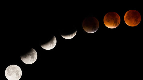
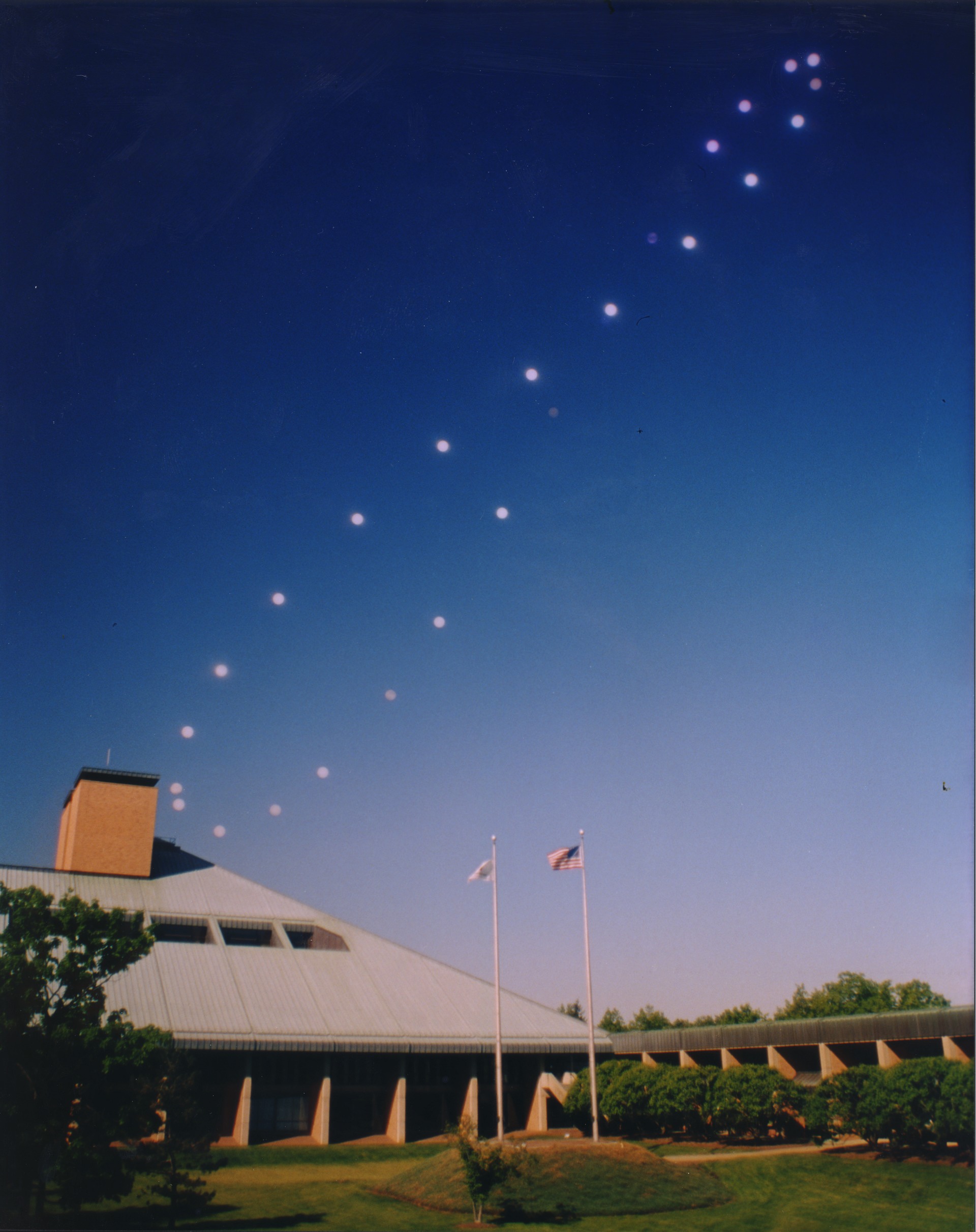
The result is that when the Earth is on one side of its orbit, the south pole is tilted toward the Sun (by as much as 23.4°) and the southern hemisphere experiences summer. Six months later, when the Earth is on the opposite side of its orbit, the north pole is tilted toward the Sun (by as much as 23.4°) and the northern hemisphere experiences summer. (Views of the Sun’s illumination on the Earth on any date are available here.) What we see from our viewpoint in the Earth’s northern hemisphere is that the Sun’s apparent daily track across the sky is much higher (that is, more northerly) in summer, and lower (more southerly) in winter. From horizon to horizon, the Sun’s track is longer in summer and shorter in winter; so that in summer, sunrises are much earlier and sunsets are much later than in winter. See, for example, the graphic above, or this photograph of the Sun’s paths through the sky at different times of the year.
 The great circle
So we are used to the fact that the length of daylight is significantly longer in summer than winter, and most of us know that the “longest day” (that is, the day when the Sun is above the horizon the longest) is the summer solstice, around June 21, when the Sun has reached its most northerly and longest track in our sky; and the “shortest day” is the winter solstice, around December 21, when the Sun has reached its most southerly and shortest track in our sky.
It would make sense, then, for the summer solstice to also be the date at which sunrise is earliest and sunset is latest; and for the winter solstice to be the date when sunrise is latest and sunset is earliest. However, that is not what happens! Nature sometimes defies our expectations.
The local meridian is a great circle passing through the celestial poles and through the zenith of an observer’s location on the planet. Image Credit: Daniel V. Schroeder
And that is because we have not talked about one other factor in sunrise and sunset times that is not at all obvious. It is that the Sun moves across the sky, in its apparent daily track, at slightly different rates at different parts of the year. Most of the Sun’s east-to-west apparent motion in the sky is caused, of course, by the rotation of the Earth, which is quite uniform (to milliseconds per day). But a small part of the Sun’s apparent daily motion depends on the position of the Earth in its orbit around the Sun. This component of the Sun’s apparent motion varies by a small amount over the course of a year due to the elliptical shape of the Earth’s orbit and to the tilt of the Earth’s axis.
Earth’s axial tilt